Town Planning as a Colonial Marketing Strategy
In the earliest years of the Swan River Settlement, town planning served a purpose far beyond
organising streets and allotments. It was a deliberate strategy to market the colony, attract
private investment and reassure prospective settlers that Western Australia offered the familiar comforts of British civilisation.
Governor James Stirling ordered Surveyor-General John Septimus Roe to survey the townsites of Fremantle and Perth before rural land-despite most settlers arriving for agricultural pursuits.
This prioritisation of urban design reveals how essential a planned townscape was to the
colony’s survival. Across the British Empire, frontier towns were often mapped and formalised
long before they had the population to fill them, projecting stability and order in otherwise
unknown landscapes.
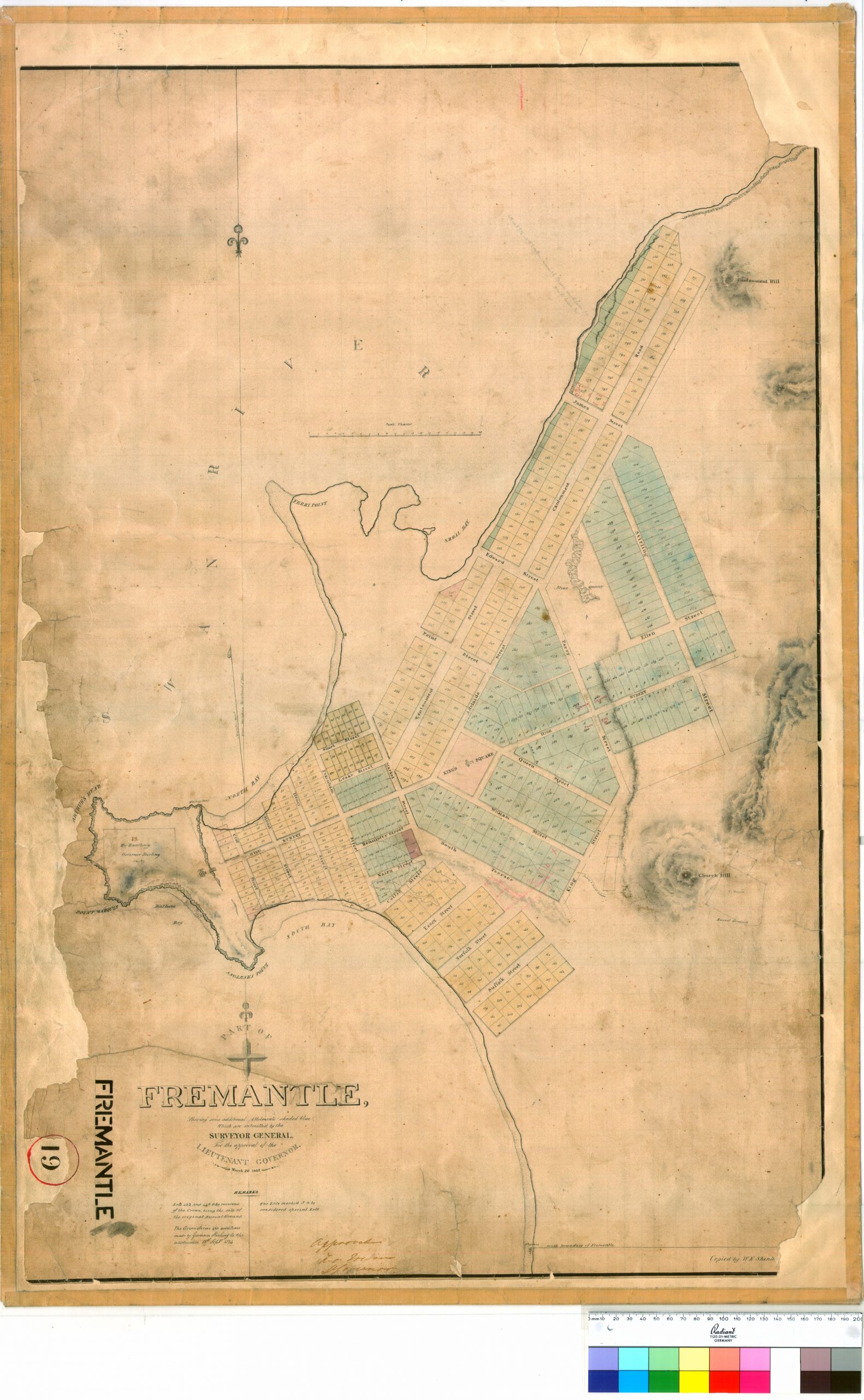
Early plans of Fremantle presented a carefully crafted image: a neat grid of wide streets,
prominent public buildings, and a civilised urban centre rising from the wilderness. The Round
House, which was placed atop Arthur’s Head, acted as both landmark and symbol-visible from land and sea, and was aligned with the church which was to be in Kings Square, embodying the moral oversight of Church and State.
Naming streets and landmarks after respected British figures and places strengthened this illusion of familiarity, linking the new colony to the cultural memory of “home.”
Through maps, names, and planned streetscapes, Fremantle became more than a
settlement-it became a persuasive argument for the viability of the Swan River Colony. This
crafted landscape helped settlers feel anchored in an unfamiliar environment and played a vital
role in the success of European settlement in Western Australia.